Image Credit: evenfh/Shutterstock.com
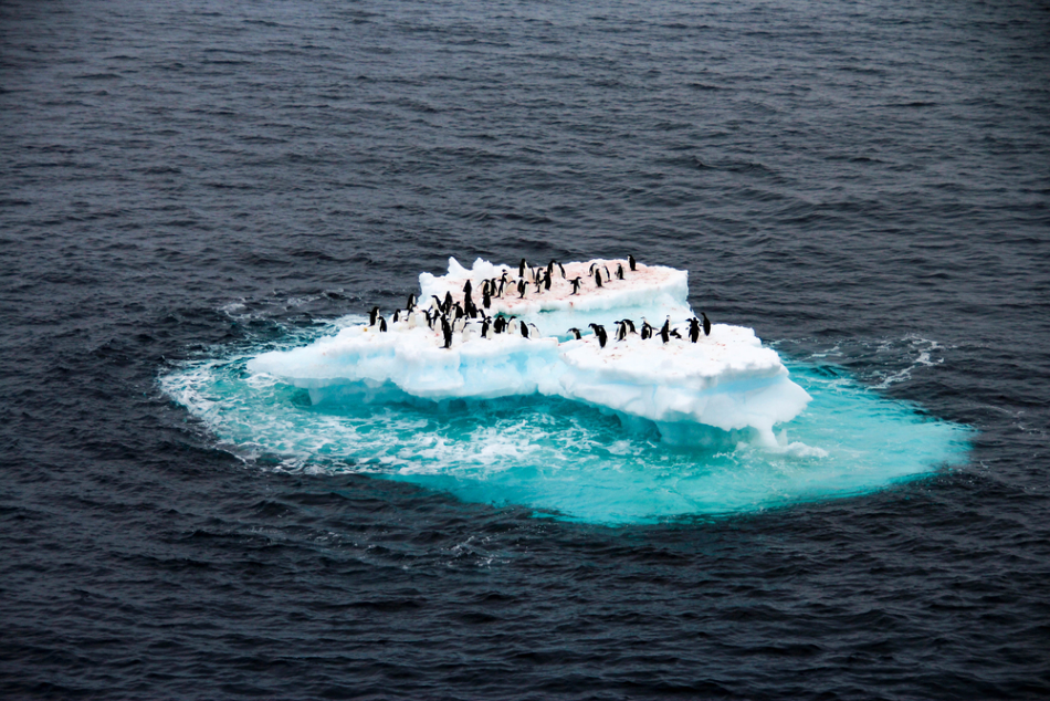
The Antarctic Peninsula is one of the harshest environments in the world, but its inhabitants – several species of penguins – are well-adapted to such challenging conditions. However, their numbers have dramatically decreased over the last few decades. Scientists point the finger at our warming climate, and aim to monitor their activity using remote sensing technologies.
Chinstrap penguins – named for the distinctive black line running under their beak from cheek to cheek – have experienced an overall 58% reduction in the number of breeding pairs along the Antarctic Peninsula in the last 50 years.
In 1971, a census of colonies on Elephant Island – an ice-covered mountainous island off the coast of Antarctica - counted 122,500 breeding pairs of chinstrap penguins. A census conducted in January 2020 found all 32 colonies on the island had experienced a decline, with an overall drop to just 52,786 breeding pairs.
Counting Penguin Colonies using Artificial Intelligence
Researchers from Stony Brook University, New York, US, spent one month counting penguins using clickers. Chinstraps tend to nest on rocky, windblown sites, which are useful for keeping eggs safe and dry, but make it difficult for scientists to research numbers accurately.
The team was joined by a robotics group from Northeastern University, Boston, US, who took footage of nesting sites with drones, and compared their count with the manual count. Artificial intelligence (AI) teaches computers how to identify nests with machine learning (ML), allowing for automated colony counting. This could improve future study accuracy and enable researchers to count colonies remotely.
The Warming Climate and the Reduction in Penguin Species
The trend continues across the Antarctic Peninsula, with many penguin species suffering a dramatic drop in numbers. Although researchers noted an increase in the gentoo penguin population (perhaps a result of a more flexible diet and breeding conditions), the overall decline is a clear, but disturbing trend, they say.
The researchers have pointed towards the warming climate as a cause of the decline. Despite their perfect adaptations and breeding success rates remaining consistent, the number of chinstrap penguins has decreased, indicating that the reduction may be the result of events occurring after they reach adolescence, such as a disruption in their climate.
Winter temperatures in and around the Antarctic Peninsula have increased by as much as 5 °C above pre-industrial levels – one of the fastest rises in the world. This has caused a fundamental change in the Southern Ocean ecosystem over the last 50 years, and has resulted in a weakened food chain.
Krill are the foundation of the marine food system, yet estimates suggest a 40% decrease in their population in the Southern Ocean. Their food source, the marine algae phytoplankton, has been affected by sea ice, which now forms later and melts earlier. This has a knock-on effect for krill predators such as the chinstraps who rely on the small crustacean as their sole food source.
Unhealthy krill populations are problematic for those further down the food chain. By reviewing chinstrap colony health, researchers can gauge the health of the krill and the overall status of the marine ecosystem.
The Emperor Penguin Struggles
Emperor penguins are now classified as ‘near threatened’, having seen a dramatic decrease of up to 50% in some areas. Emperors are affected by changes in their climate, such as warmer temperatures causing sea ice melt, which alters their habitat and the availability of food.
A study published in 2014 suggested that the population of Emperor penguins could fall by 19% by 2100.
Remote Sensing Systems for Penguin Monitoring and Protection
A high-tech, remote sensing system has already hinted that Emperor penguins are struggling to find food because of the continuing loss of sea ice and reduced volumes of plankton and fish further up the food chain.
The system could help researchers keep an eye on penguins and help protect them from extinction by offering a way to monitor the species more closely, including measuring how prediction models are performing, and when and which colonies around Antarctica are likely to survive for the longest.
A time-lapse camera around 100 feet away from the colony captures a picture every minute, which is matched with data on air temperature, wind speed, humidity and solar radiation. It has shown Emperor penguins huddling together for warmth and to conserve energy even though temperatures outside are considered warm. This suggests the birds have less body fat as a result of their dwindling food supply.
Antarctica is one of the most remote, challenging and expensive places to conduct science. Therefore, this technology makes the task more cost-effective and safer, as online remote technology can be checked by researchers thousands of miles away.
Census Using Satellite Imagery
Some studies have utilized very high resolution (VHR) satellite imagery from European Space Imagery and DigitalGlobe, for example, to determine where colonies are or have been on the ice. Since Emperor penguins breed almost exclusively on sea ice, they appear as several or single pixels within an image.
Used in conjunction with medium resolution imagery, VHR satellite data can help researchers identify colonies along the entire coastline of Antarctica. For the first time, researchers can gain an accurate overview and estimate the penguins’ entire population from space.
Remote sensing technology has led to breakthroughs in the understanding of Emperor penguins, including that there are more of them than previously thought.
Stronger Action Required
While Emperor penguins are now classified as near threatened, their chinstrap counterparts are not. Although it is estimated that there are more than 8 million of these penguins, there are calls for them to be classified as a species of concern Campaigners have highlighted the need for greater wildlife protection in the world’s most remote areas and stronger actions against climate change.
The use of time-lapse cameras, drones and satellites provide researchers with information about penguin colonies that might otherwise be difficult to obtain regularly, and without ever having to make contact with them.
This can help the researchers monitor the penguins’ plight in real-time and allow them to advise on action against additional pressures on the ecosystem, and establishing large marine protection areas.
References and Further Reading
Baker A, (2020) Climate Change is Decimating the Chinstrap Penguins of Antarctica [Online] Time. Available at: https://time.com/5781302/climate-change-is-decimating-the-chinstrap-penguins-of-antarctica/ (Accessed 31st March 2020)
Watts J, (2020) Alarm over collapse of chinstrap penguin numbers [Online] The Guardian. Available at: https://www.theguardian.com/world/2020/feb/11/antarctic-alarm-collapse-chinstrap-penguin-numbers-global-heating (accessed 31st March 2020)
Chow D, (2018) How spying on penguins just might save them [Online] Mach (NBC News) Available at: https://www.nbcnews.com/mach/science/how-spying-penguins-just-might-save-them-ncna874321 (Accessed 31st March 2020)
European Space Imaging (2019) Penguins From Space: VHR Satellite Imagery to Decrease Vulnerability [Online] European Space Imaging. Available at: https://www.euspaceimaging.com/penguins-from-space-vhr-satellite-imagery-to-decrease-vulnerability/ (Accessed 1st April 2020)
Disclaimer: The views expressed here are those of the author expressed in their private capacity and do not necessarily represent the views of AZoM.com Limited T/A AZoNetwork the owner and operator of this website. This disclaimer forms part of the Terms and conditions of use of this website.