A swarm of drones for coordinated observation. Image Credit: Dongxu Yang.
Yet, current emission records suffer from a lack of transparency and accuracy due to a limited understanding of CO2 emissions from cities and crucial sectors. This limitation results in uncertainties within the global carbon budget, underscoring the need for more accurate data collection and reporting methods.
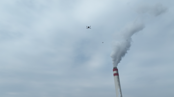
A research team under the leadership of Dr Dongxu Yang from the Institute of Atmospheric Physics (IAP) at the Chinese Academy of Sciences has recently launched the Low-cost UAV Coordinated Carbon Observation Network (LUCCN).
LUCCN is equipped with medium-accuracy greenhouse gas sensors designed for measuring CO2 levels. This innovative network combines ground-based and UAV-based in-situ measurement tools, significantly improving the capacity to detect and quantify point source emissions in three-dimensional space.
Their findings have been published in the journal Advances in Atmospheric Sciences on October 2nd, 2023.
The existing and even near future satellite measurements cannot meet the frequent monitoring requirements for anthropogenic emissions due to cloud cover, aerosols, and revisit patterns.
Dr. Dongxu Yang, Institute of Atmospheric Physics, Chinese Academy of Sciences
Hence, creating a flexible observation network holds paramount importance in ensuring the precision of monitoring and data acquisition related to greenhouse gas emissions.
Employing the LUCCN system, the researchers conducted a campaign in Shenzhen, Guangdong Province, and Nanning, Guangxi Zhuang Autonomous Region. Their primary focus was monitoring greenhouse gas emissions from urban areas and critical sectors.
After data collection, the conversion of CO2 concentration data into emission intensity plays a crucial role in validating emission inventories. In this study, the research team employed UAV-measured data to compute emission flux using a cross-sectional flux (CSF) method.
The CSF method yielded a slightly higher estimate compared to the Open-source Data Inventory for Anthropogenic CO2 (ODIAC). This discrepancy can be attributed to the limitations inherent in UAV in-situ measurements.
ODIAC, on the other hand, is a global high-resolution emission dataset specifically designed for fossil fuel CO2 emissions. It was originally developed as part of the Greenhouse gas Observing SATellite (GOSAT) project at the National Institute for Environmental Studies (NIES) in Japan.
The UAV sampling strategy and emission estimation methods require further exploration. We are now developing a measurement-fed-perception self-adaptation network strategy for the LUCCN system to improve monitoring efficiency and atmospheric inversion will be applied to enhance emission estimates.
Dr. Dongxu Yang, Institute of Atmospheric Physics, Chinese Academy of Sciences
Journal Reference:
Yang, D., et al. (2023). Toward Establishing a Low-cost UAV Coordinated Carbon Observation Network (LUCCN): First Integrated Campaign in China. Advances in Atmospheric Sciences. doi.org/10.1007/s00376-023-3107-5.