Wildfires are increasing in frequency and intensity, with evidence that climate change has played a key role in recent years. While lightning strikes and human activity are responsible for starting wildfires, climate change has created the perfect conditions that allow them to ignite much more easily.
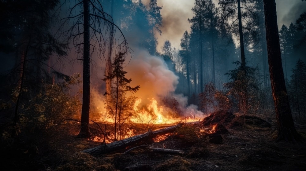
Image Credit: POLACOSTUDIOS/Shutterstock.com
It is impossible to pinpoint exactly where and when a wildfire will start with absolute precision, but advanced weather forecasting technology can highlight potential fire hotspots and give authorities a head-start in protecting people, animals, and the local environment.
Wildfires in California
In the US state of California, the wildfire season was traditionally July to October, but wildfires are now a threat all year round. So far in 2025, according to the Californian Department of Forestry and Fire Protection, there have been 314 wildfires, with 48,336 acres consumed at the time of writing. Over 16,000 structures have been destroyed in California alone.1
Warmer winter weather, strong winds, and bountiful dry vegetation provided optimal conditions for Californian wildfire ignition and spread—with devastating consequences.
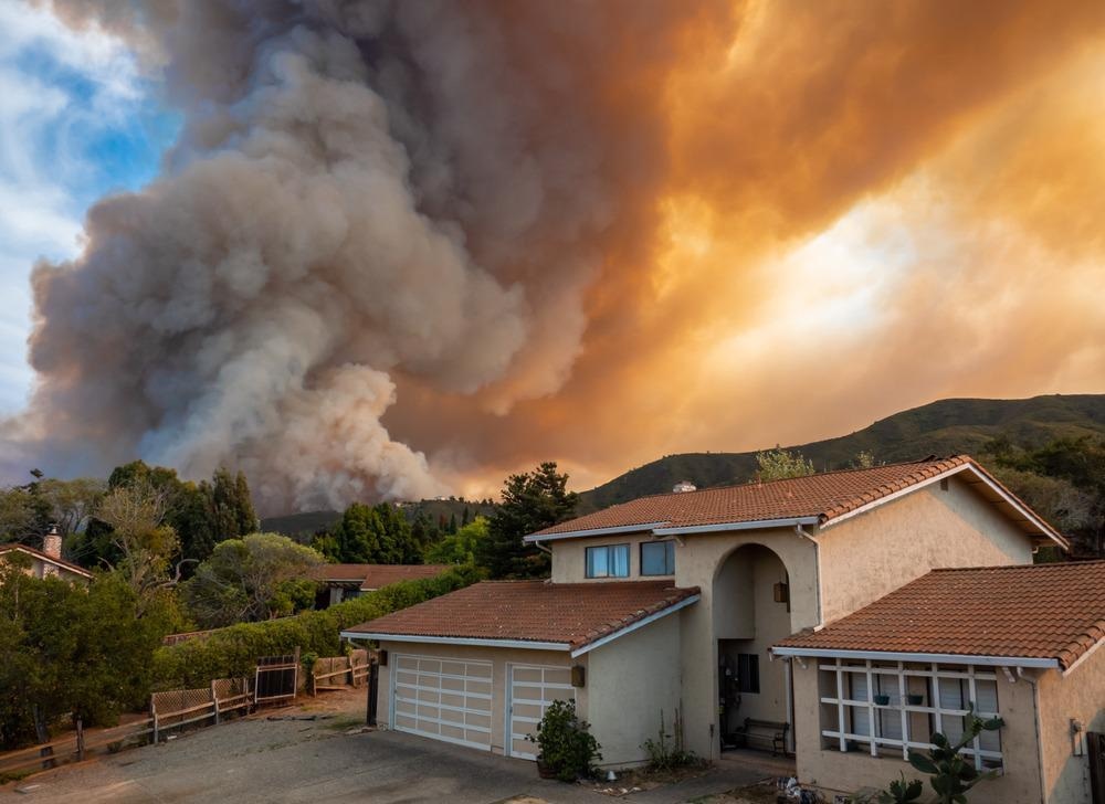
California has been a victim of climate change with rainfall declining by 30% and increased temperatures of 3 °F since 1980. Image Credit: David A Litman/Shutterstock.com
Since the start of the 20th century, temperatures in California have risen by almost 3 °F.2 Global warming is predicted to only make wildfires worse in the future. Rainfall in California has declined by over 30% since 1980 alone.
Wildfires in Australia
Wildfires ravaged more than 50 million hectares of land in Australia in 2019. Researchers from the Royal Netherlands Meteorological Institute pointed to global warming as the cause, arguing that the record warm temperatures and dryness caused the severe wildfires, before concluding that widespread burning was at least 30% more likely than in a world without global warming, i.e., before 1900.3
How Do Wildfires Start?
Over 80% of wildfires in America are started by people accidentally or intentionally, but fires can also ignite spontaneously if conditions are favorable or during electrical storms. A wildfire needs fuel, oxygen, and heat to ignite and sustain itself, and weather can influence all of these.
Building materials and dried vegetation act as kindling, igniting faster and burning better in temperate, drier conditions. Winds carry oxygen and drive flames toward other fuel sources; higher winds carry fires faster and further, often starting new blazes downwind, meaning fires spread over long distances without being directly connected.
Timing is also an important factor. Wildfire ignition favors high temperatures, quicker and variable winds, and little moisture in the air – and these are all found in the early afternoon when most blazes start.4
Wildfires 101 | National Geographic
Video Credit: National Geographic/YouTube.com
Predicting Fires with Weather Forecasting Solutions
Fire weather is complex, and previous efforts at forecasting risk have been simplistic and inaccurate, but the increasing number of wildfires worldwide is driving the need for more precise forecasting of potential fire hotspots.
Researchers working in the field are improving models for wildfire prediction by studying controlled fires to understand how they travel. Meanwhile, meteorologists use the latest technology to identify potential fire hotspots, continuously creating and updating maps based on forecasted weather conditions critical to fire conditions.
DTN has developed a live Geographic Information System (GIS) that enables users to forecast, analyze in real time, map past, present, and future weather, and identify locations of fires or potential blaze sites.4 The system’s predictive weather intelligence and IR satellite capabilities help users predict the likelihood of fires and other weather phenomena, such as storms.
Sophisticated imaging systems can show fire locations in real time, allowing for a live look at the conditions using a GIS layer service containing the latest fire hotspot data and also showing the likelihood of a fire."
Renny Vandewege, Vice President, Weather Operations, DTN
Machine Learning Wildfire Prediction
Over the past few years, unprecedented wildfire seasons have focused researchers' attention on innovative technology-based solutions to predicting fire risk. One such innovative solution has come from artificial intelligence (AI) and Machine Learning (ML).
In recent years, ML has become increasingly integrated into weather forecasting systems. Intricate dynamic factors govern wildfires, and ML can be trained on vast datasets to predict the likelihood of a wildfire breaking out in a certain area under certain conditions.
The European Centre for Medium-Range Weather Forecasts (ECMWF) has developed a new ML-based wildfire prediction and prevention tool. According to its developers, the Probability of Fire (PoF) tool can provide forecasts for up to 10 days before a wildfire occurs. In addition to its predictive capabilities, PoF benefits from low computational cost. It can also perform global 1 km forecasts.
The system was trained on historical datasets of satellite observations, specifically from MODIS, and anticipates when and where fires will occur. However, ECMWF has emphasized that this system is only as good as the satellite data it is trained on: training it on multiple satellite datasets will significantly improve PoF’s fire prediction capabilities.5
Conclusion
Wildfires threaten public safety, buildings, and infrastructure. Their repercussions can be devastating for people and wildlife. Weather is a powerful and variable natural phenomenon, but meteorological science and innovative forecasting technology have the potential to better predict where and when a wildfire might start.
Utilizing innovative technologies will allow authorities to pinpoint fire hotspots and identify blazes more accurately, removing the element of surprise and allowing them to be prepared and reactive, as well as manage fires in a safe and coordinated way.
Climate change is profoundly impacting the frequency and intensity of wildfires worldwide. With better predictive capabilities, multiple lives, buildings, and billions of dollars could be saved every year.
Continue Reading: Satellite Technology in Wildfire Monitoring: A Global View on Fire Prevention
References and Further Reading
- DTN (2021) Increasing Fire Risks Threaten Utilities, DTN, https://www.dtn.com/increasing-fires-risks-threaten-utilities-new-technology-is-critical-for-predicting-locating-wildfires/. Accessed 22 March 2021.
- DTN, Geographic Information Systems, DTN, https://www.dtn.com/weather/utilities/gis/. Accessed 22 March 2021.
- Foerster, J. (2020),The Science Of Fire Weather And Using It To Predict Wildfires, Forbes, https://www.forbes.com/sites/jimfoerster/2020/09/16/wildfires-and-hurricanes-take-your-pick-of-extreme-weather/?sh=6fdbaedc2aaa. Accessed 22 March 2021.
- Mulkern, AC. (2020) Climate Change Has Doubled Riskiest Fire Days in California, Scientific American, https://www.scientificamerican.com/article/climate-change-has-doubled-riskiest-fire-days-in-california/. Accessed 22 March 2021.
- Fountain, H. (2020) Climate Change Affected Australia’s Wildfires, Scientists Confirm, New York Times, https://www.nytimes.com/2020/03/04/climate/australia-wildfires-climate-change.html. Accessed 22 March 2021.
- Baraniuk, C. (2018) The quest to predict – and stop – the spread of wildfires, BBC Future, https://www.bbc.com/future/article/20180924-the-quest-to-predict-and-stop-the-spread-of-wildfires. Accessed 22 March 2021.
- USDA Forest Service - Northern Research Station (2018) Fire weather prediction improving, ScienceDaily, https://www.sciencedaily.com/releases/2018/09/180912132702.htm. Accessed 22 March 2021.
Disclaimer: The views expressed here are those of the author expressed in their private capacity and do not necessarily represent the views of AZoM.com Limited T/A AZoNetwork the owner and operator of this website. This disclaimer forms part of the Terms and conditions of use of this website.