Storms, floods, droughts, and landslides are just a few examples of hydrometeorological hazards that can be caused by climate change or extreme meteorological events. With these hazards accounting for most of the natural disasters that occur worldwide, robust hydrometeorological monitoring systems are needed to improve preparedness and mitigation measures. But what are hydrometeorological monitoring systems and how are they used?
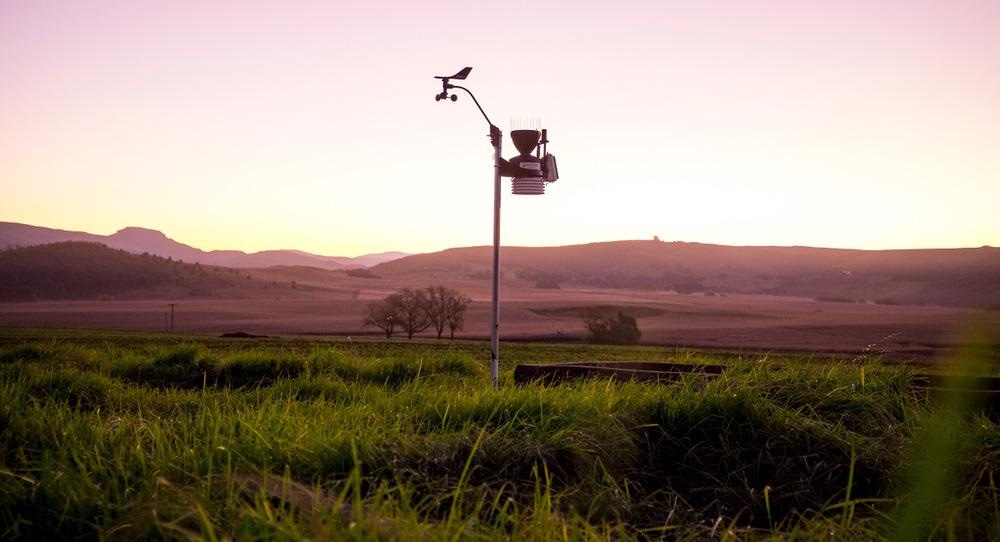
Image Credit: Cameron Watson/Shutterstock.com
What are Hydrometeorology Studies and Why are they Important?
Hydrometeorology studies the energy, chemistry, physics, and water fluxes in the atmosphere and the Earth’s surface.
This science measures and understands the hydrological phenomena that occur in the atmosphere and the ground; it puts particular emphasis on the interactions between the two.
The hydrological cycle describes the transport cycle of water that links the land, oceans, and atmosphere. Water moves between the atmosphere, earth, and oceans through processes such as precipitation and evaporation. Water is transported within the earth via surface run-off and infiltration.
Hydrometeorological monitoring systems encompass the tools that measure change within the many variables of the hydrological cycle. These monitoring and information systems are used in several critical applications. These applications and services are typically used to:
- Predict, forecast, and give early warning on hydrometeorological hazards, allowing communities and governments to develop adequate preparedness, prevention, and mitigation strategies.
- Assist in water resource management and allocation, as well as drought forecasting. This can also include assessments of water quality and ecotoxicological evaluations.
- Monitor, assess, and mitigate any climate-related risks.
How are they Applied in Different Settings?
Different technologies and monitoring systems assess various hydrometeorological phenomena.
Hydrometeorological monitoring uses several types of technology such as radars, advanced weather balloons, satellites, and numerical and mathematical models. These technologies are often used alongside other hydrometeorological devices and synoptic weather stations to pull together robust weather data. These solutions are used in many communities to monitor the variables within the hydrological cycle. Some examples include:
- Precipitation
- Evaporation
- Fluxes of water vapor between soil, vegetation, and the atmosphere
- Soil moisture
- Groundwater
- River flows
- Surface-water stores (e.g. reservoirs and lakes)
- Sediment loads and water quality
- Freshwater ecology
Hydrometeorological monitoring systems support several critical services. An example of this is flash flood risk management. As flash floods occur over very short timescales and are usually very localized, it can be difficult to develop accurate and timely warnings.
Prevention measures and monitoring systems for rainfall-induced flash floods can vary between regions and countries. However, generally speaking, these systems monitor a vast number of variables in real-time, such as the intensity of rainfall and the accumulated amount of precipitation.
These measurements are carried out by various in-situ and remote sensing systems such as satellites or radar. This information can then be combined with other data, such as the moisture levels in the soil (e.g. from past rainfall) and the characteristics of the land to carry out modeling of local areas.
Landslide risk management is another application that uses hydrometeorological monitoring systems. Indicators that are assumed to be precursors of landslides are monitored continuously. Relevant indicators include rainfall, soil displacements, and groundwater level. Alarms are transmitted to key decision-makers when the values for these indicators exceed pre-defined thresholds.
Current Applications of Hydrometeorological Monitoring
The hydrometeorological monitoring initiative of the Mekong River plays an important role in local communities. It gives near real-time weather information and has the capability to give early warnings. The system also supports water resource management and development.
Changes to river flows can be triggered by natural events such as monsoons and individual storms. They can also be brought about by other factors such as human activities, climate change, and deforestation.
The hydro-met stations installed along the Mekong River spans several countries. The stations are capable of drought monitoring and providing near real-time water level and precipitation data. The data can be used for river monitoring and forecasting. The information system allows member countries to access reliable and accurate data along the whole length of the river from the upper river in China to the Delta in Vietnam.
The Joint Typhoon Warning Center (JTWC) uses its synthetic aperture radar (SAR) to provide detailed information on tropical cyclones.
In particular, it provides detailed views of wind patterns and speeds along the surface of oceans as storms and hurricanes travel and evolve. In October 2020, during Typhoon Goni, the JTWC gathered SAR data about the storm before it landed. The SAR data allowed the JTWC to fine-tune their forecasts and analyses, which helped drive the evacuation of more than 350,000 people.
Latest and Future Research of Hydrometeorological Monitoring
To keep up with the ever-changing climate and planet, there is a need for the development of more accurate and complex equipment, models, and instruments. This need is answered, at least in part, by the recent advances in satellites, which are heavily relied upon in most hydrometeorological monitoring systems.
The Meteosat Third Generation satellites are due to be launched from 2022 onwards to improve the forecasts of weather and, in particular, severe storms.
NASA aims to launch four Earth science missions in 2022. The missions will be carried out using its fleet of Earth-observing satellites. The missions will gather more information on the Earth’s climate system and processes. To help this analysis, data will be gathered to monitor tropical cyclones, atmospheric dust, extreme storms, and surface water and oceans.
The future of hydrometeorological monitoring looks promising with the continual improvement of technology. Aside from the development of more advanced satellites and instruments, advancements in alternative technologies such as drones will improve data-gathering initiatives, particularly in inaccessible areas.
Incorporating artificial intelligence and machine learning into data modeling is also expected to significantly improve the capabilities of current and future hydrometeorological monitoring systems.
References and Further Reading
Valipour, M. et al. (2020) ‘Hydrometeorology: Review of Past, Present and Future Observation Methods’, Hydrology, [online]. Available at: https://www.intechopen.com/chapters/74255
Mekong River Commission. (n.d.) Hydrometeorological Monitoring [online]. Mekong River Commission. Available at: https://www.mrcmekong.org/our-work/functions/basin-monitoring/hydrometeorological-monitoring/
Foundation for Water Research. (n.d.) The Hydrological Cycle [online]. Foundation for Water Research. Available at: https://fwrinformationcentre.co.uk/html/hydrological-cycle.html
Centre for Ecology & Hydrology. (n.d.) International Hydrometeorological Services [online]. Centre for Ecology & Hydrology. Available at: https://www.ceh.ac.uk/sites/default/files/HydrometCapabilities-small.pdf
World Meteorological Organization. (2012) Management of Flash Floods [online]. World Meteorological Organization. Available at: https://library.wmo.int/doc_num.php?explnum_id=7337
Casagli, N. et al. (n.d.) Hydrological risk: landslides [online]. Available at: https://drmkc.jrc.ec.europa.eu/portals/0/Knowledge/ScienceforDRM/ch03_s02/ch03_s02_subch0305.pdf
Jackson, C. et al. (2021) Chasing Cyclones from Space [online]. Eos. Available at: https://eos.org/features/chasing-cyclones-from-space
European Organisation for the Exploitation of Meteorological Satellites (n.d.). Meteosat Third Generation [online]. European Organisation for the Exploitation of Meteorological Satellites. Available at: https://www.eumetsat.int/meteosat-third-generation
The National Aeronautics and Space Administration (n.d.). NASA To Launch 4 Earth Science Missions in 2022 [online]. The National Aeronautics and Space Administration. Available at: https://www.nasa.gov/feature/esnt/2021/nasa-to-launch-4-earth-science-missions-in-2022
Disclaimer: The views expressed here are those of the author expressed in their private capacity and do not necessarily represent the views of AZoM.com Limited T/A AZoNetwork the owner and operator of this website. This disclaimer forms part of the Terms and conditions of use of this website.