May 13 2019
The most significant component of the climate system on Earth is the global ocean. The oceans store heat energy and conduct heat from the tropics to higher latitudes, acting extremely slow in response to atmospheric changes.
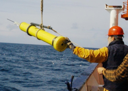 Deployment of an APEX float from a German research ship. (Image credit: http://www.argo.ucsd.edu/pictures.html)
Digital gridded climatologies of the global ocean offer useful background information for various geochemical, oceanographic, and biological applications. As the observational basis and the global ocean are changing, regular updates of ocean climatologies are required, which are in agreement with the recommendations of World Meteorological Organization to provide decadal updates of atmospheric climatologies.
Constructing ocean climatologies consists of several steps, including data quality control, adjustments for instrumental biases, and filling the data gaps by means of a suitable interpolation method.
Viktor Gouretski, Professor, University of Hamburg
Prof. Gouretski is a scholarship holder of the Chinese Academy of Sciences’ President’s International Fellowship Initiative (PIFI) at the Institute of Atmospheric Physics, Chinese Academy of Sciences. He is also the author of a report published recently in Atmospheric and Oceanic Science Letters.
“Sea water is essentially a two-component system, with a nonlinear dependency of density on temperature and salinity, with the mixing in the ocean interior taking place predominantly along isopycnal surfaces. Therefore, interpolation of oceanic parameters should be performed on isopycnals rather than on isobaric levels, to minimize production of artificial water masses. The differences between these two methods of data interpolation are most pronounced in the high-gradient regions like the Gulf Stream, Kuroshio, and Antarctic Circumpolar Current,” added Prof. Gouretski.
Recently, in a report presented by Prof. Gouretski, a new World Ocean Circulation Experiment/ARGO Global Hydrographic Climatology (WAGHC), with salinity and temperature averaged on local isopycnal surfaces, was introduced. On the basis of high-quality ship-board data as well as salinity and temperature profiles from ARGO floats, the new climatology has a resolution every month and is available on a 1/4° latitude–longitude grid.
We have compared the WAGHC climatology with NOAA’s WOA13 gridded climatology. These climatologies represent alternative digital products, but the WAGHC has benefited from the addition of new ARGO float data and hydrographic data from the North Polar regions. The two climatologies characterize mean ocean states that are 25 years apart, and the zonally averaged section of the WAGHC-minus-WOA13 temperature difference clearly shows the ocean warming signal, with a mean temperature increase of 0.05 °C for the upper 1500-m layer since 1984.
Viktor Gouretski, Professor, University of Hamburg